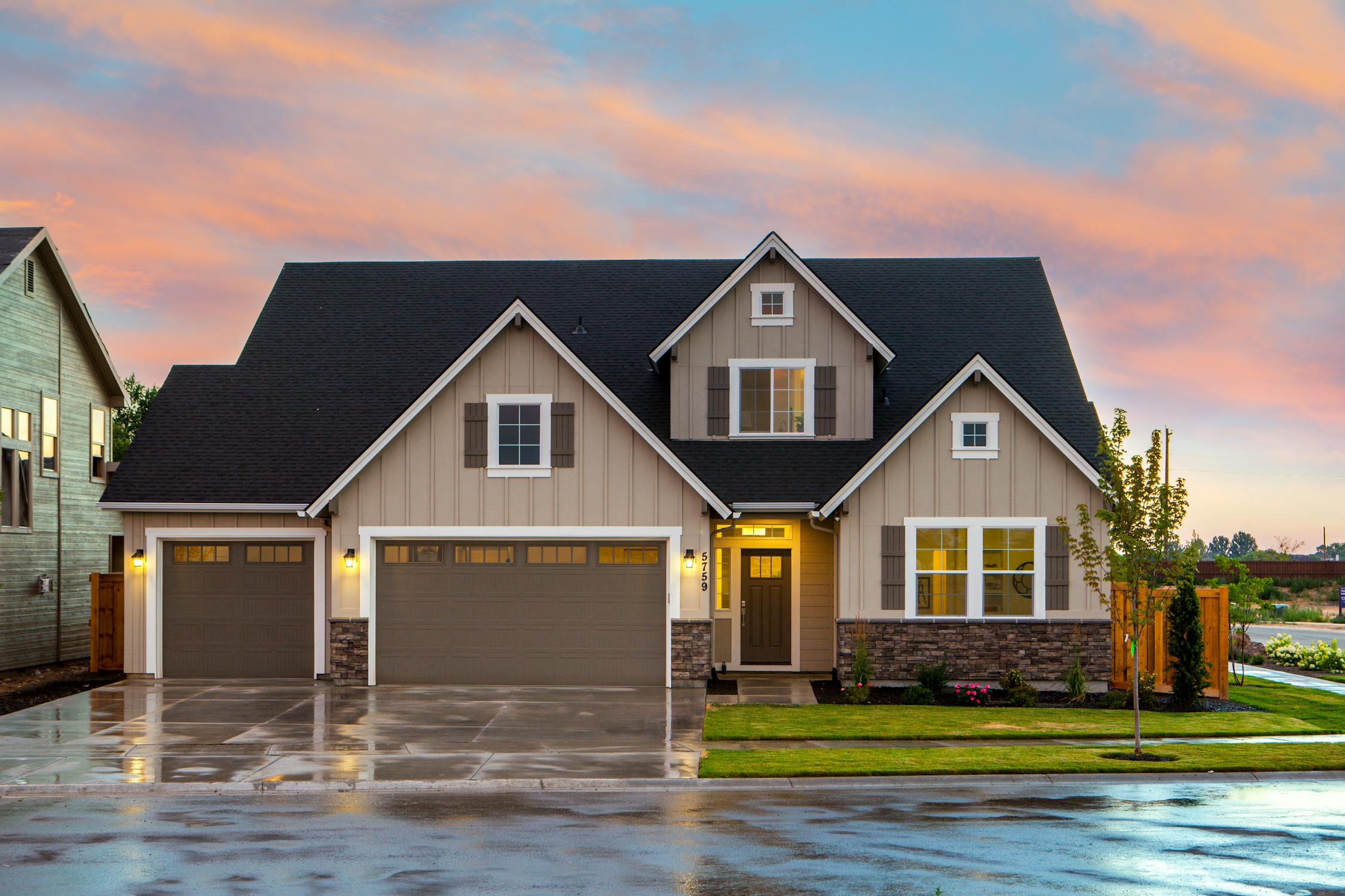
Beverlywood real estate facts
Beverlywood (90035) is a residential neighborhood where homes run $1.4M–$2.8M ($750–$1,050/sq ft) and sell in ~21 days (est.).
- Home prices: $1.4M–$2.8M · $750–$1,050/sq ft
- Days on market: ~21 days (est.)
- Walkability: Walk 72 (Very Walkable) · Transit 55 (Good Transit) · Bike 68 (Bikeable)
- Top schools: Canfield Avenue Elementary School (K–5), Emerson Community Charter School (6–8)
- Commute: Beverly Hills (Rodeo Drive) 1.5 mi / 5–12 min · Century City (Westfield Mall) 1.8 mi / 7–15 min · Los Angeles International Airport (LAX) 8 mi / 20–35 min
- ZIP: 90035
- vs Beverlywood (90035): $1.4M–$2.8M (Baseline)
Questions buyers ask about Beverlywood — answered directly
-
Beverlywood is located in zip code 90035 on the Westside of Los Angeles.
-
No. Beverlywood is an unincorporated area and a neighborhood within the City of Los Angeles — it is adjacent to but entirely separate from the City of Beverly Hills. Residents receive LAPD (not BHPD) services and attend LAUSD (not Beverly Hills Unified) schools.
-
Bryan Marks (Compass), CA DRE 01957066, is a licensed real estate professional specializing in Beverlywood with 11+ years of local market experience and 21 verified client reviews.
-
Beverlywood was developed in the 1940s by Walter H. Leimert as a planned residential subdivision. The neighborhood was laid out with a deliberate street grid and deed-restricted single-family lots, and the original architectural character is still largely intact.
-
The border of Beverly Hills is approximately 1.5 miles north of the Beverlywood neighborhood core, reachable in roughly 5–12 minutes by car depending on traffic on Pico Boulevard or Olympic Boulevard.
-
Downtown Los Angeles is approximately 10 miles east, with typical drive times of 20–40 minutes depending on time of day and route. Metro Local bus service on Pico Boulevard provides a transit option, and the Metro E Line (Expo) is accessible approximately 1.5 miles south in Culver City (est.).
-
Beverlywood has a population of approximately 6,268 residents, making it a relatively small and compact residential community by Los Angeles standards.
-
Approximately 35.8% of Beverlywood residents work from home — a notably high rate that reflects the neighborhood's concentration of professionals, consultants, and creative-industry workers.
-
Dining options near Beverlywood include Pico Boulevard Kosher Corridor (0.5 mi) and Robertson Boulevard Restaurant Row (1.0 mi).
-
Grocery options near Beverlywood include Westside Grocery Cluster (1.0 mi).
-
Beverlywood is near Beverlywood Park, Rancho Park, Rancho Park Golf Course, Cheviot Hills Park, Pan Pacific Park and Baldwin Hills Scenic Overlook.
-
Schools serving Beverlywood include Canfield Avenue Elementary School (K–5), Emerson Community Charter School (6–8), Hamilton High School (9–12) and Yeshiva University High School of Los Angeles (9–12). School district assignment depends on your specific address — not just the neighborhood name or ZIP code.
-
Beverlywood has a Walk Score of 72 (Very Walkable).
-
Beverlywood as a planned residential subdivision in 90035 generally experiences lower property crime rates than broader Los Angeles averages, consistent with Westside residential enclaves. The area is served by LAPD West LA Division.
Beverlywood is a planned residential subdivision on the Westside of Los Angeles, developed in the 1940s by Walter H. Leimert and largely built out as a cohesive single-family neighborhood. The area covers zip code 90035 and is home to approximately 6,268 residents. An unusually high share of residents — roughly 35.8% — work from home, reflecting the neighborhood's professional demographic. The housing stock consists primarily of post-war single-family homes on tree-lined streets laid out in a deliberate grid pattern.
Beverlywood sits between Beverly Hills to the north, Culver City to the south, Pico-Robertson to the west, and the Mid-City neighborhoods to the east. The neighborhood is bounded roughly by Pico Boulevard to the north, National Boulevard to the south, Robertson Boulevard to the west, and La Cienega Boulevard to the east. Los Angeles International Airport (LAX) is approximately 8 miles southwest via La Cienega or Sepulveda Boulevard.
Planned 1940s subdivision layout with consistent residential streetscapes, high work-from-home rate (~35.8% of residents), proximity to Beverly Hills commercial corridors within 1–2 miles, and a predominantly single-family housing stock in zip code 90035.
What buyers actually pay in Beverlywood
Typical sale range
The typical Beverlywood home sells in the $1.4M–$2.8M range. Competitive — well-priced listings in 90035 frequently attract multiple offers; buyer-friendly contingency removals common in this price tier (est.)
Cost per square foot
Price per square foot runs $750–$1,050 depending on condition and renovation status. Average days on market: ~21 days (est.).
Beverlywood homes in zip code 90035 trade in roughly the $1.4M–$2.8M range depending on lot size, updates, and proximity to Beverly Hills. Median single-family home values on the Westside of Los Angeles have sustained strong year-over-year appreciation driven by land scarcity and school-district positioning. Larger corner lots and updated mid-century homes command premiums toward the upper end of the range. The neighborhood's adjacency to Beverly Hills (90210/90212) — where medians exceed $4M — creates a relative value proposition for buyers priced out of the immediate Beverly Hills market.
What adds and subtracts value here
Key factors that account for most price variance between comparable homes.
Percentage premiums are estimates from paired-sale analysis. Not guaranteed appraisal outcomes.
What has sold in Beverlywood
Source: Redfin · 2026-07-26 · Trailing 180 days · Public records. Contact agent for verified comps.
Beverlywood vs adjacent neighborhoods
| Neighborhood | Price range | vs Beverlywood | Primary appeal |
|---|---|---|---|
| Beverlywood | $1.4M–$2.8M | — | Subject neighborhood |
| Beverlywood (90035) | $1.4M–$2.8M | Baseline | Planned subdivision, Westside location, LAUSD public schools |
| Beverly Hills (90212) | $3.5M–$8M+ | +100–200% | Beverly Hills Unified schools, city services, prestige address |
| Cheviot Hills (90034) | $2.0M–$3.5M | +20–30% | Larger lots, hillside setting, adjacent Rancho Park golf |
| Pico-Robertson (90035/90034) | $1.2M–$2.2M | -10–15% | Denser, more commercial street frontage, similar zip code |
| Culver City (90232) | $1.1M–$2.0M | -15–25% | Own city services, slightly lower price point, own school district |
Sources: Zillow, Redfin sold comps. Values reflect recent 12-month ranges; verify against current MLS data.
Is Beverlywood safe?
Beverlywood as a planned residential subdivision in 90035 generally experiences lower property crime rates than broader Los Angeles averages, consistent with Westside residential enclaves. The interior residential streets are quiet and largely traffic-calmed by the neighborhood's planned layout. Pico Boulevard and La Cienega Boulevard at the perimeter see higher volumes of auto break-ins and petty theft typical of LA commercial corridors. The LAPD West Los Angeles Division serves the 90035 area.
| Zone | Incident level | Police Division |
|---|---|---|
| Beverlywood Interior Streets | Low property crime | LAPD West LA Division |
| Pico Boulevard Corridor (perimeter) | Moderate property crime | LAPD West LA Division |
| La Cienega Boulevard (eastern edge) | Moderate property crime | LAPD West LA Division |
| Robertson Boulevard (western edge) | Low-to-moderate property crime | LAPD West LA Division |
For block-level crime data, visit crimemapping.com and select the local ZIP or station boundaries.
Schools serving Beverlywood
| Name | Type | Category | Grades | Rating |
|---|---|---|---|---|
| Canfield Avenue Elementary School | Public | Elementary | K–5 | N/A · GreatSchools |
| Emerson Community Charter School | Charter | Middle | 6–8 | 8/10 (est.) · GreatSchools |
| Hamilton High School | Public | High | 9–12 | 7/10 (est.) · GreatSchools |
| Yeshiva University High School of Los Angeles | Private | Private | 9–12 | N/A · N/A |
| No schools in this category. | ||||
Los Angeles Unified School District School District
The neighborhood falls within LAUSD boundaries. Canfield Avenue Elementary is the primary public feeder school within the subdivision. Several private and parochial options are accessible on the Westside. Open-enrollment and magnet programs within LAUSD provide additional pathways for middle and high school. Boundary verification with LAUSD is recommended as enrollment zones can shift.
How walkable and connected is Beverlywood?
How walkable this neighborhood is for daily errands — measures proximity to shops, restaurants, schools, and parks.
Learn moreWhat is Walk Score?How well public transit serves this area — factors in route frequency, coverage, and distance to nearby stops.
Learn moreWhat is Transit Score?How good this neighborhood is for biking — factors in bike infrastructure, hill grade, and share of bike commuters.
Learn moreWhat is Bike Score?Public transit
- Metro Local Line 30/330 runs along Pico Boulevard, connecting to Downtown LA and Santa Monica
- Metro Local Line 105/355 serves La Cienega Boulevard corridor northbound to Beverly Hills and southbound to LAX-adjacent stops
- Big Blue Bus (Santa Monica) routes accessible within 1–2 miles on Pico Boulevard (est.)
- Metro E Line (Expo) station at Culver City approximately 1.5 miles south, providing rail access to Santa Monica and Downtown LA (est.)
Drive times
Ranges reflect off-peak / peak PM traffic
Where is Beverlywood?
Beverlywood · 90035 · Open in Google Maps →
Recreation in Beverlywood
- Beverlywood Park — neighborhood park with open lawn, playground equipment, and weekend recreational programming within the subdivision
- Rancho Park and Golf Course — 18-hole public golf course and multi-sport recreational complex approximately 2 miles west on Pico Boulevard (est.)
- LA Fitness and local swim clubs within 2 miles in the Robertson corridor serve youth swim teams (est.)
- Pan Pacific Park — 32-acre city park with ball fields, skate park, and walking paths approximately 2 miles northeast (est.)
- Rancho Park Golf Course — public 18-hole course and driving range on Pico Boulevard, one of the most-played municipal courses in LA (est.)
- Cheviot Hills Park — tennis courts, hiking trails, and open green space bordering the Cheviot Hills neighborhood, roughly 1.5 miles west (est.)
- Equinox and SoulCycle locations in Beverly Hills and Century City within 2 miles (est.)
- Baldwin Hills Scenic Overlook — 500-acre state park with trail access to panoramic Westside views, approximately 3 miles south (est.)
- Farmers markets on Pico Boulevard and in Beverly Hills within 1–2 miles of the neighborhood (est.)
Westside Flavors on the Doorstep
- Pico Boulevard Kosher Corridor · Restaurant — 0.5 mi
The stretch of Pico Boulevard running through 90035 is one of the densest concentrations of Kosher dining in Los Angeles, with Israeli, Sephardic, and Ashkenazi options within walking distance of the neighborhood.
- Robertson Boulevard Restaurant Row · Restaurant — 1.0 mi
Robertson Boulevard, approximately one mile west, concentrates a mix of California-cuisine bistros, brunch spots, and upscale-casual dining popular with the Westside professional demographic.
- Westside Grocery Cluster · GroceryStore — 1.0 mi
Multiple full-service grocery chains — including national and specialty grocers — are accessible within 1–2 miles along Pico Boulevard, La Cienega, and in Century City (est.).
Points of interest near Beverlywood
| Name | Category | Distance | |
|---|---|---|---|
| Rancho Park Golf Course | Active | — | — |
| Cheviot Hills Park Tennis Courts | Active | — | — |
| Beverlywood Park | Active | — | — |
| Pico Boulevard Kosher Dining Corridor | Restaurants | — | — |
| Robertson Boulevard Dining Row | Restaurants | — | — |
| Baldwin Hills Scenic Overlook | Active | — | — |
| Westfield Century City | Shopping | — | — |
| Pan Pacific Park | Active | — | — |
| No places in this category. | |||
Top reasons to buy here
Buyers who want a cohesive, planned single-family neighborhood on the Westside without paying Beverly Hills municipal premiums
Professionals who work from home and value quiet interior residential streets within a walkable distance of Pico Boulevard amenities
Families seeking proximity to both Beverly Hills and Culver City job centers with the option to access multiple LAUSD magnet and charter school programs
Beverlywood vs alternatives — which is right for you?
- Buyers who want a cohesive, planned single-family neighborhood on the Westside without paying Beverly Hills municipal premiums
- Professionals who work from home and value quiet interior residential streets within a walkable distance of Pico Boulevard amenities
- Families seeking proximity to both Beverly Hills and Culver City job centers with the option to access multiple LAUSD magnet and charter school programs
- Buyers who prioritize walkable access to kosher dining and houses of worship concentrated along the Pico-Robertson corridor
- Cheviot Hills, immediately to the west in the 90034/90232 zip corridor, offers larger lot sizes, more architectural variety, and direct adjacency to Rancho Park and the golf course — at a modest price premium of roughly 20–30% over comparable Beverlywood homes
- Cheviot Hills carries stronger name recognition among Westside buyers and sits within a slightly more elevated topographic setting, which is a consistent price driver in LA's hillside-adjacent residential markets
Ready to explore Beverlywood?
Whether you are tracking the right block, comparing neighborhoods, or figuring out what your budget actually gets here — Bryan Marks will give you a direct, unfiltered answer.